MAPxMAP Free app for iPhone and iPad
Developer: Satoshi Ohmichi
First release : 19 Feb 2012
App size: 2.9 Mb
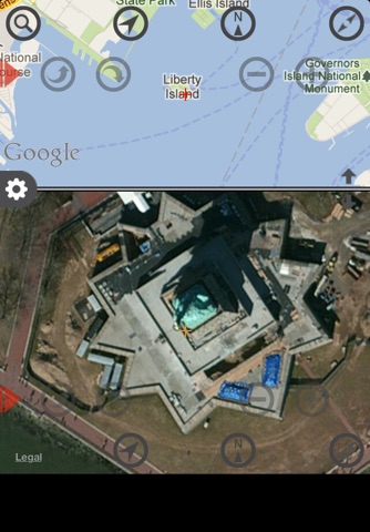
It is a simple application which has arranged two maps up and down!
A wide-area map + detailed map and standard map + aerial photograph etc. can be seen simultaneously.
- Two maps are displayed up and down. (Standard / Satellite / Hybrid)
- The lower map can synchronize a position and a rotation state with the upper map.
- By making a center bar go up and down, the size of an up-and-down map is changeable.
- Map will rotate automatically according to the current direction by the compass feature.
- Expansion/reduction of a map, and rotation of a map are possible at one-touch control.
- It can move to the named point by address search.
- A map can be freely rotated by gesture with 2 fingers.
- Two-point Hazamas distance is easily measurable. (km/mile/m/yd)
- Call two-point Hazamas course search simply. (Standard map application)


